
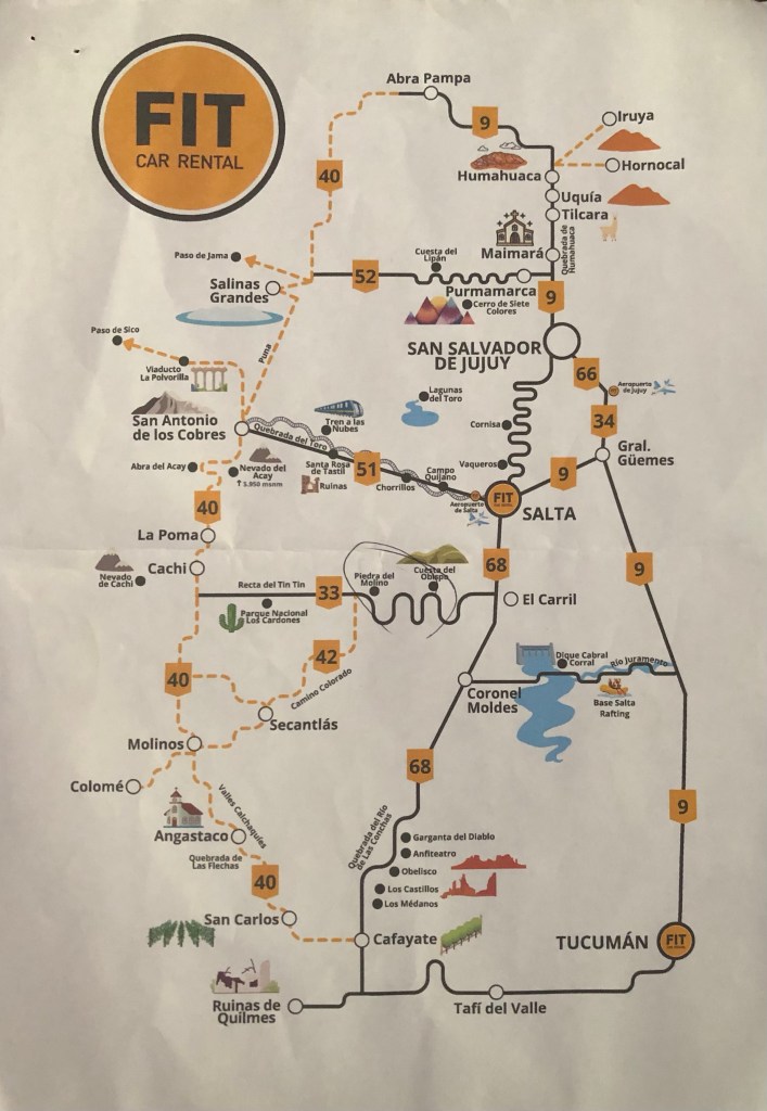
I had booked a Renault Sandero hire car through Fit Car Rental and was delighted to find, on picking it up, that it was lovely and compact, and in very good condition (apart from a few scratches and one dent which were already noted on the paperwork). It came with a full petrol tank and I was told to return it full. And surprisingly, it only had 4600 km on the odometer!
I drove very cautiously out of the garage and nervously made my way out of central Salta with the aid of Google maps on my phone. It’s a long time since I’ve driven on the right hand side of the road and it took me a while to get the hang of the traffic and figure out which roads were one-way vs two-way (most roads in Salta are one-way, it turns out) but it was probably only about 15 minutes until I reached a dual carriageway – at which point things got a lot easier.
I had planned to drive to Purmamarca the first day (a 2.5 hour journey passing San Salvador de Jujuy on the way) but then drive back to Jujuy to spend the night. This was purely based on altitude – I really don’t sleep well at altitude and Purmamarca is at 2324m whereas Jujuy is at 1259m. It meant a bit of extra driving but I figured it was worth it for a decent night’s sleep.
Apart from a really annoying section of roadworks and diversions on the way from Salta to Jujuy, the journey went smoothly. I soon noticed that drivers in Argentina tend to largely ignore speed limits – the limit on dual carriageways is 110km per hour, but once on the single carriageway it is often posted as 60 or even 40 – and most people will be driving at speeds anywhere between 80 and 120! I was overtaken a lot on that first day before I finally decided “when in Rome” and started driving at whatever speed I felt comfortable with!
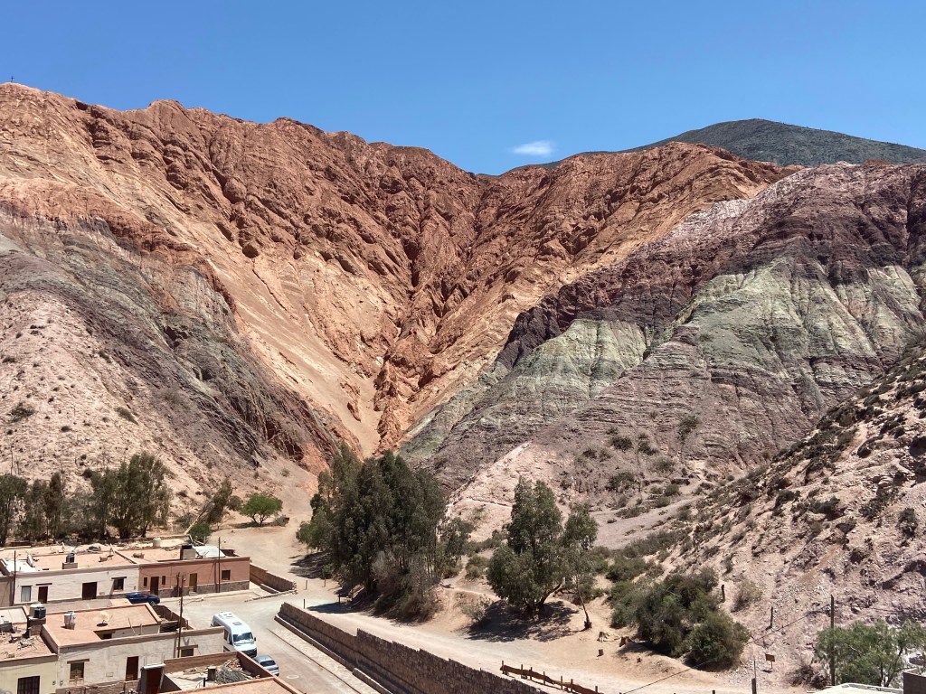
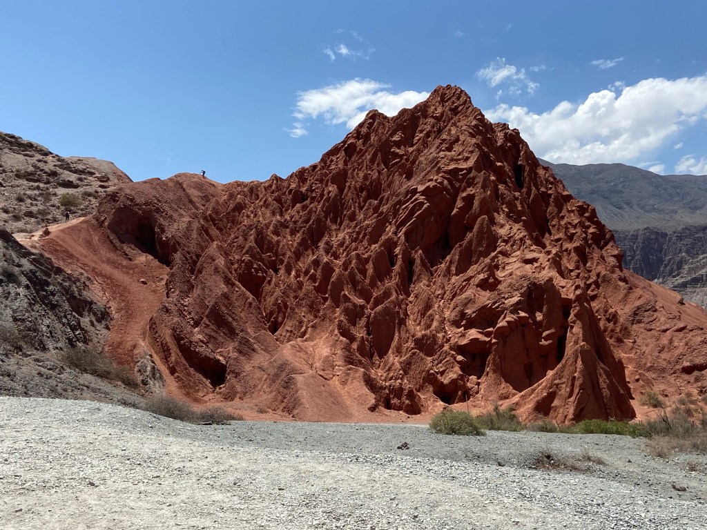
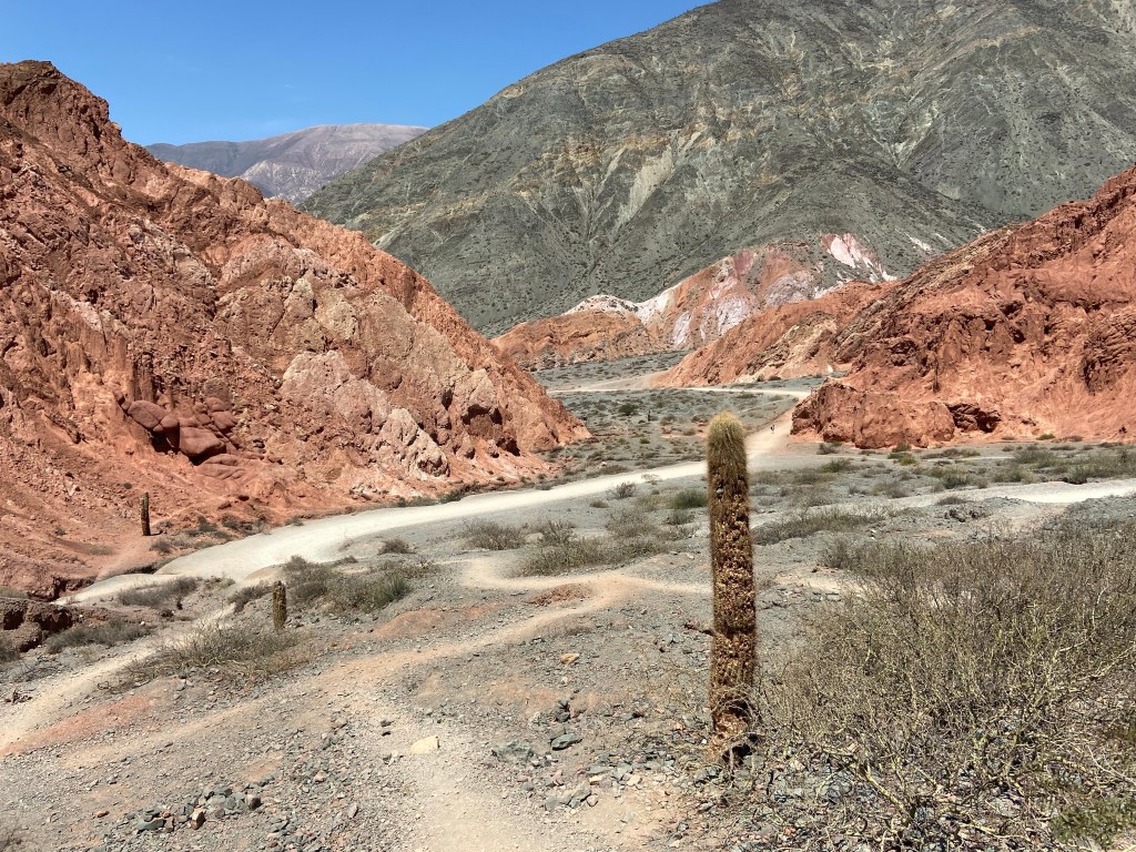
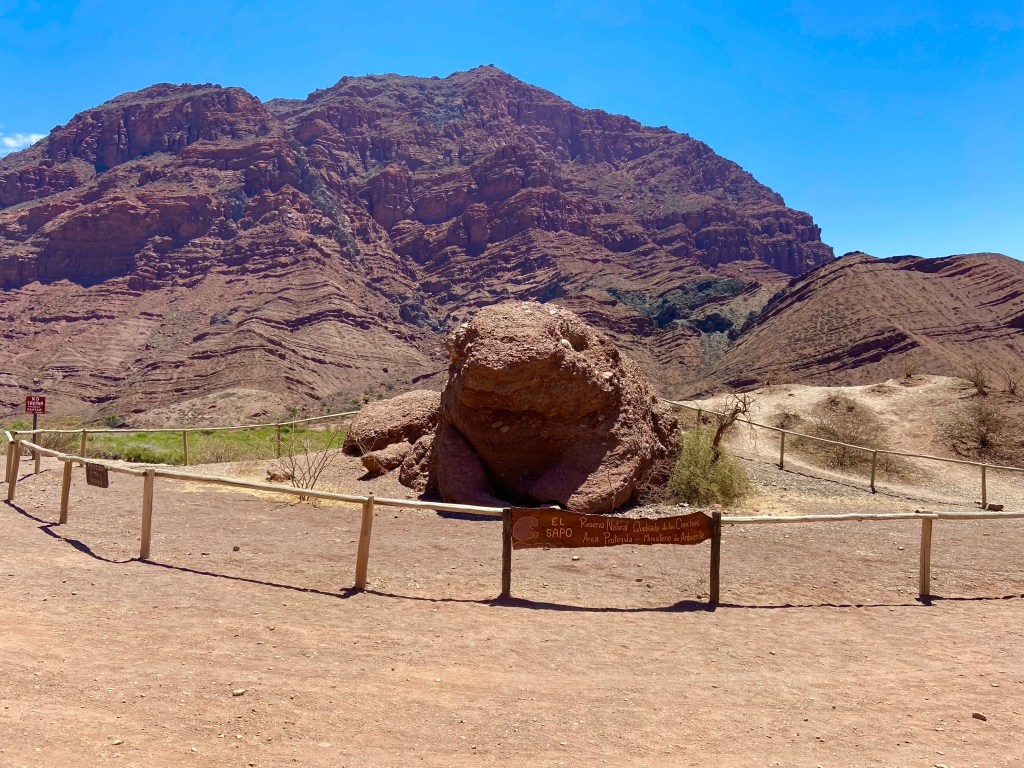
At Purmamarca I stopped to admire the 7-colours mountain that is the local tourist attraction, and did a short hike around the mountainside that takes about an hour – which felt like more than long enough in the searing heat!

I then made my way back to Jujuy, arriving relatively early (around 3.30 pm) which gave me plenty of time to shower and hang out in the air conditioned room before heading out later to find some food.
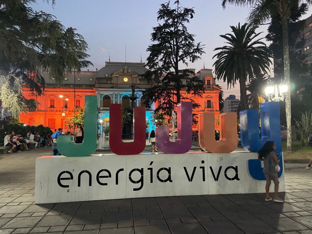
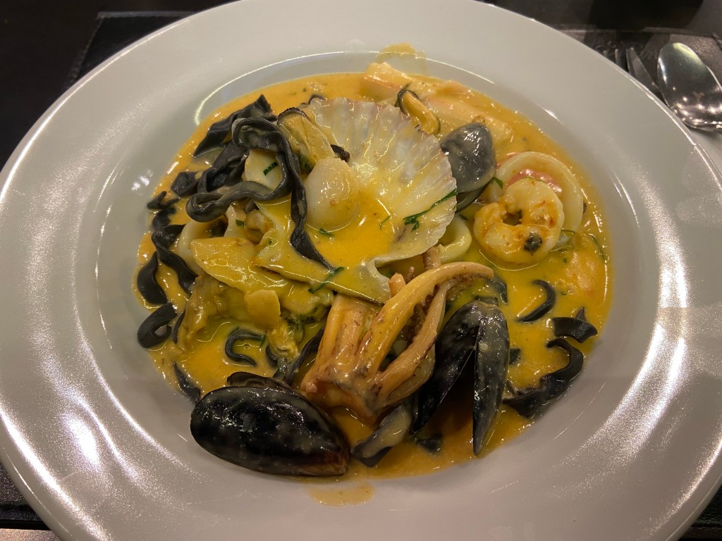
I had read that Jujuy is not really worth visiting and sadly have to agree. I had a delicious meal of squid ink pasta with seafood, and a good night’s sleep, but the town doesn’t have the beauty and charm of Salta, and generally looks a bit run down, so I wouldn’t recommend it as a stop for anyone who is okay sleeping higher up!

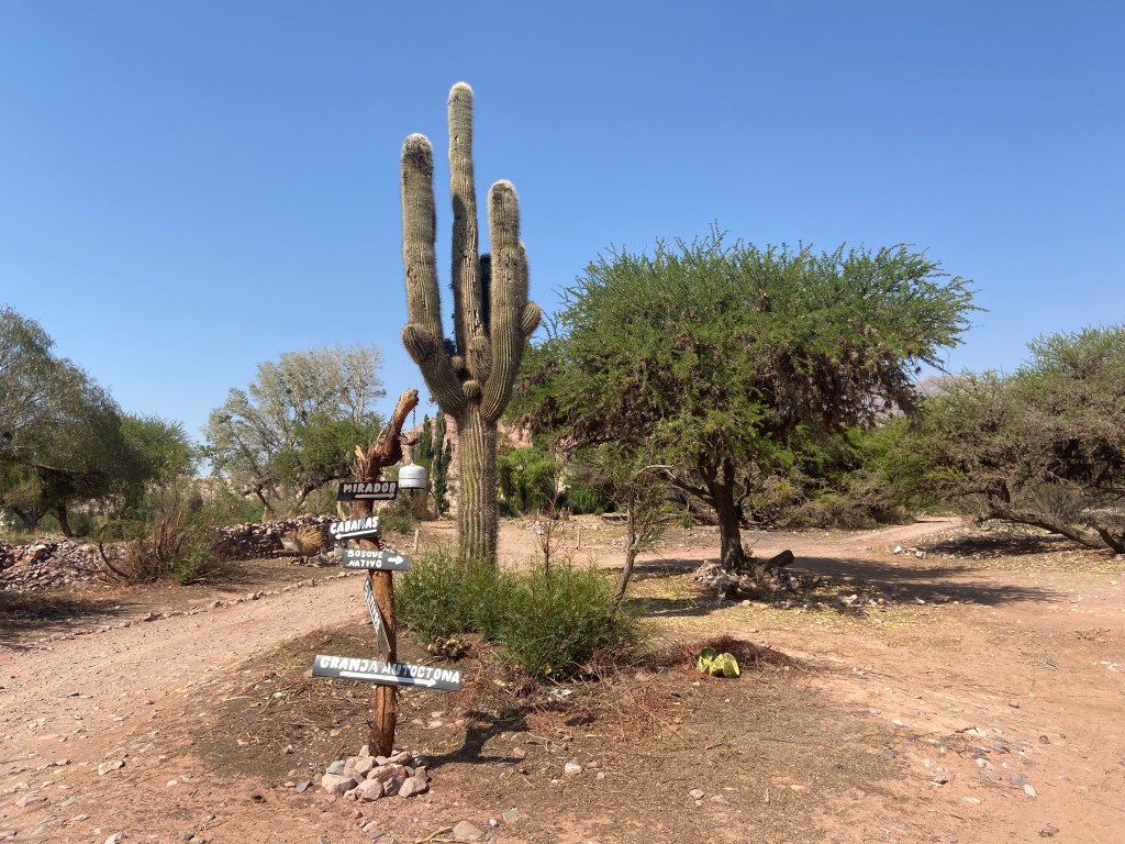
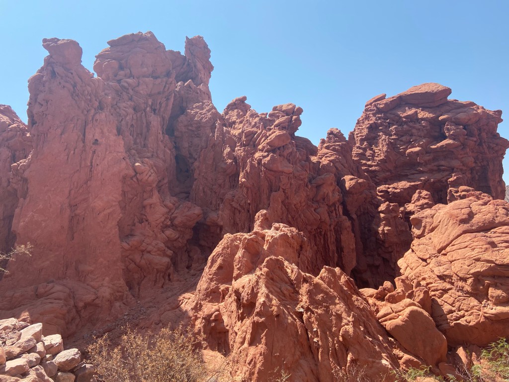
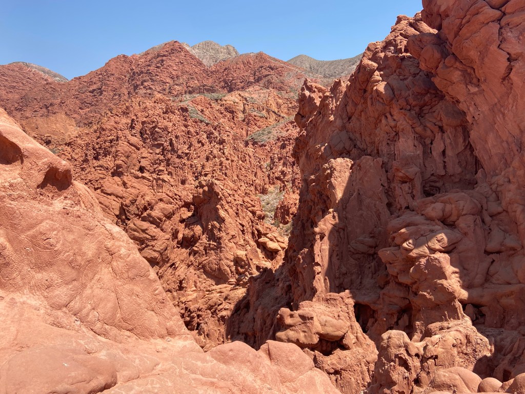
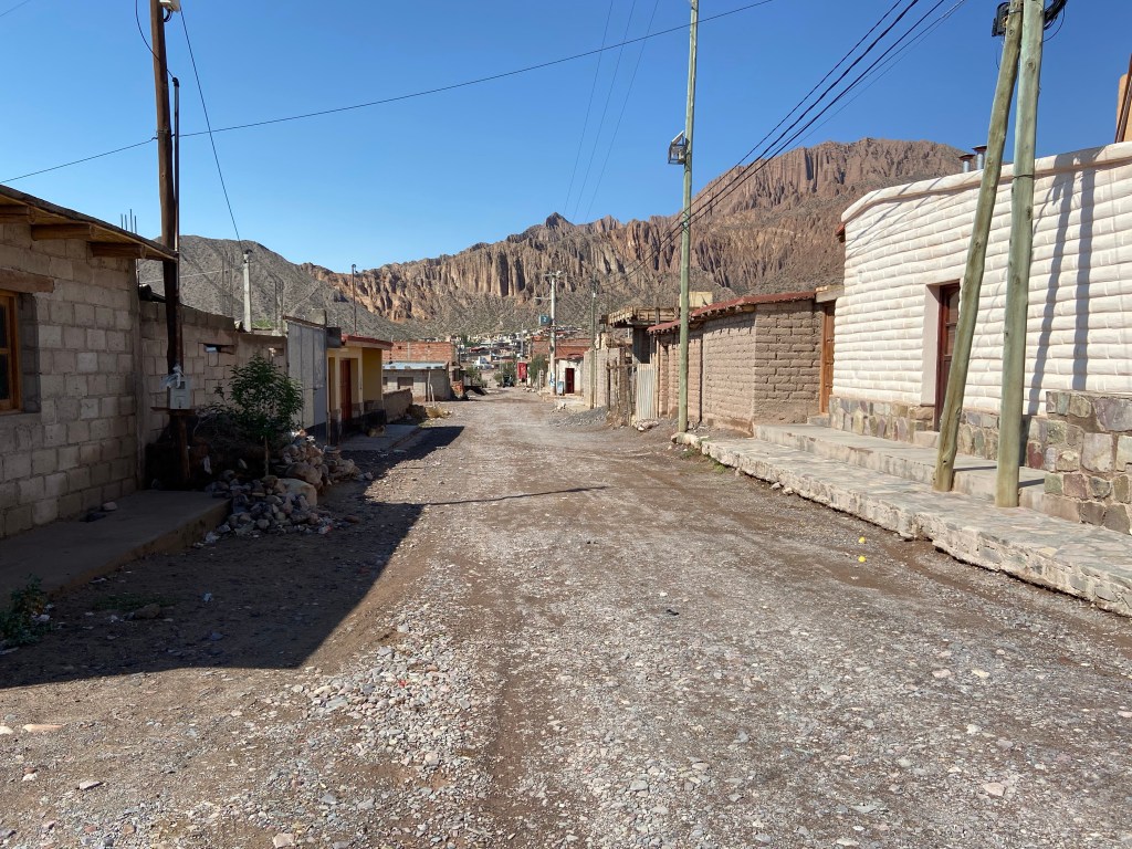
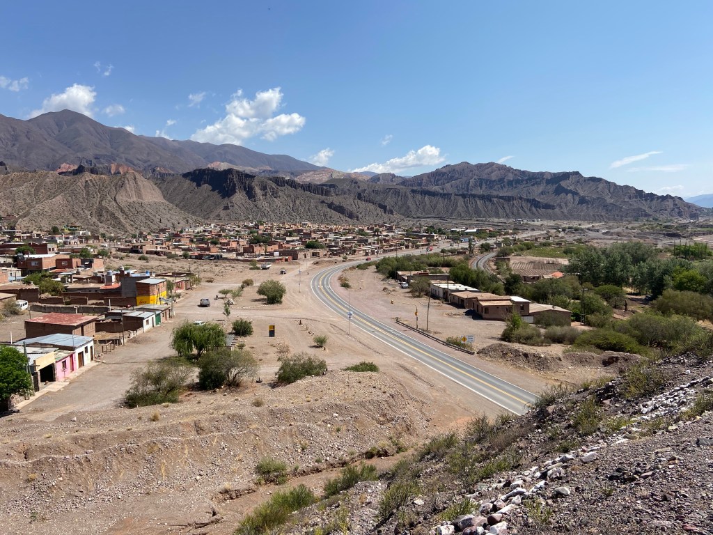
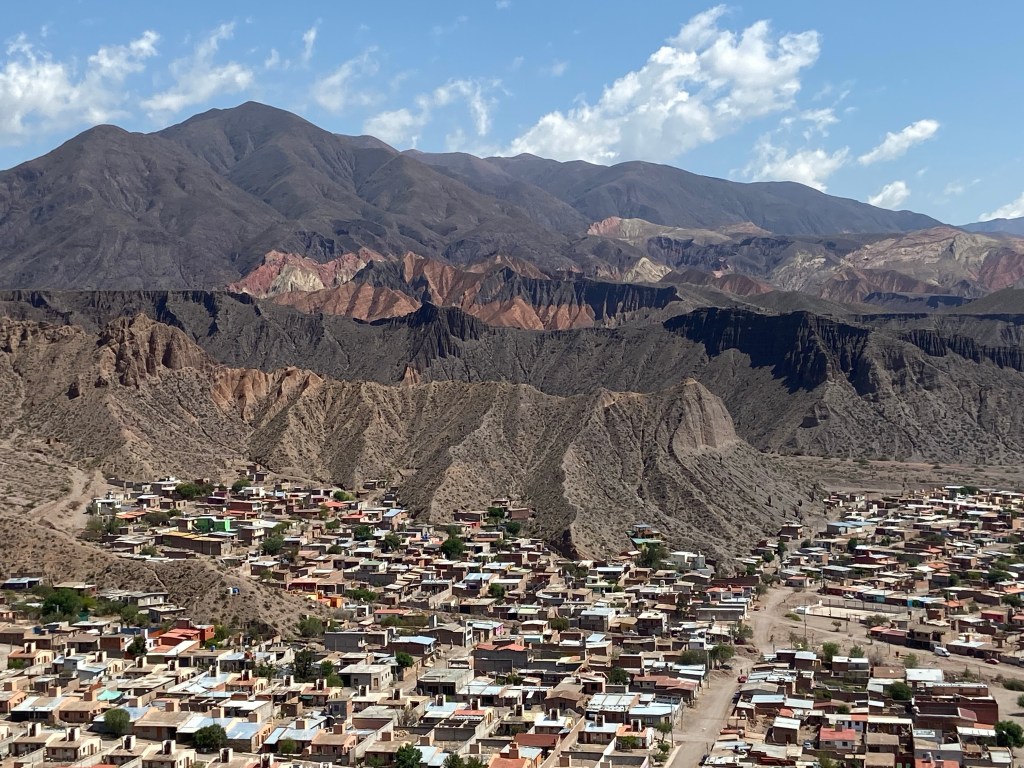
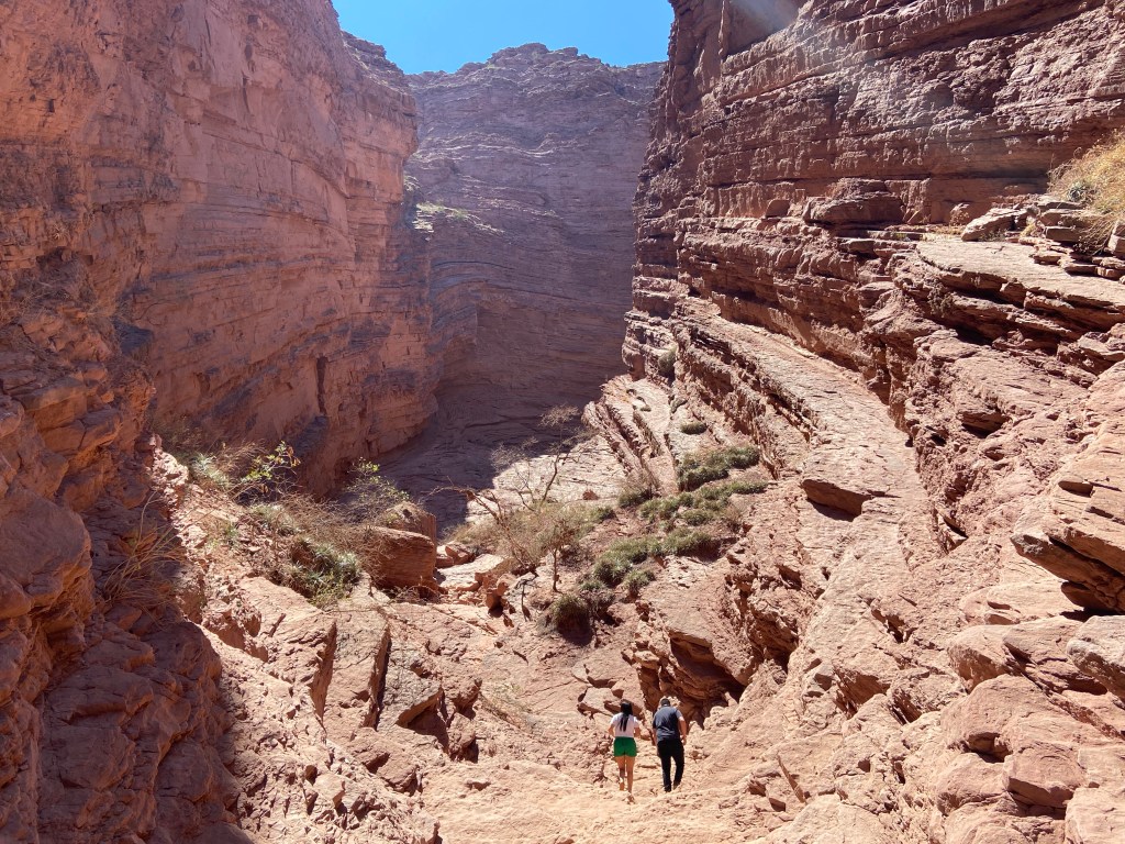
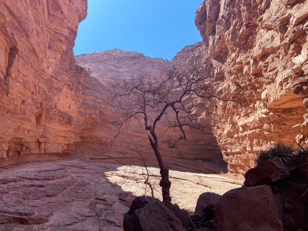
The next day I drove first to Uquia where I planned to do the “Las Senoritas” hike that I’d read about and seen photos of on various blogs. I wasn’t entirely sure where the start of the hike was, but as I approached Uquia I saw it signposted at the side of the road – so parked the car and headed up the clearly signposted trail.
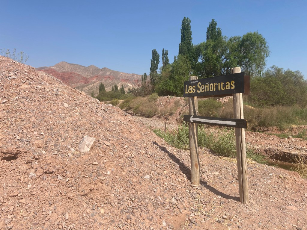
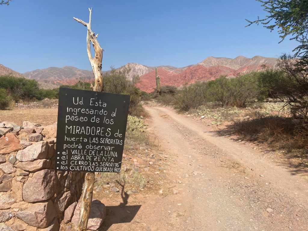

But after reaching a viewpoint at which a signpost pointed the way ahead, I appeared to lose the trail. Suddenly there were no further signs and I was just heading straight up the valley in the direction of the mountains ahead, but with no idea which way I should go to find the beautiful canyon that I’d seen in pictures.
Spotting a clear section of trail a few hundred meters to my right, and a group of people stood on the hilltop above, I headed that way, which is where my problems began!
It turned out the group I’d seen were with a guide, and a very officious woman approached me as I reached the point where they had been standing (they’d moved on by this point) and asked incredulously if I was hiking alone. I responded in the affirmative, which greatly displeased her – apparently hiking alone is strictly forbidden and I should have been with a guide! She was mystified as to how I’d even come to be in that spot as it turned out there is a large car park just above the hillside which everyone else drives to and which is the official starting point! I tried to explain that I had simply followed signs from the roadside but this entire conversation was in Spanish and I simply didn’t have the necessary vocabulary, so it was a very halting process. And with no phone signal in the area, I couldn’t use Google Translate!
She pointed me in the direction of the guides’ hut where a large board is posted showing the permitted route.
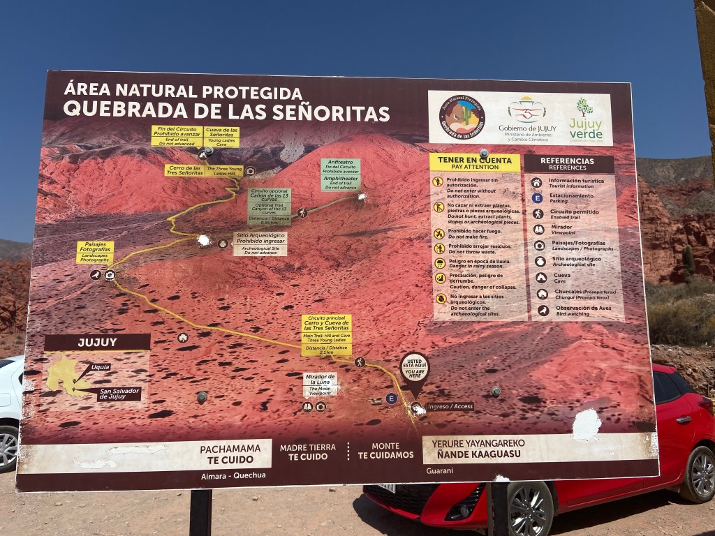
Okay, I thought, so if I stick to the permitted route surely I can continue alone? I took a photo of the board and headed back in the direction of the trail – at which point the woman got really angry and yelled at me again for trying to hike alone! I sighed and showed her the photo on my phone, pointing to the “permitted route” wording, but she insisted that this means permitted only with a guide. At this point she started barking into her radio to someone at the guides’ hut and sent me back to get myself a guide.
After another halting conversation, this time with the officer in the guides’ hut, I paid 300 pesos (about 30p) for an entrance fee and was then told I needed to wait for further people to turn up to form a group with a guide. The guide would cost 2,000 pesos (about £2) but this was payable at the end.
After about 15 minutes, eventually we had a group of 8, including a family with two very young kids, and an elderly couple with clear mobility issues. The guide spoke entirely in Spanish, telling us the tour would take about an hour and a half, but maybe longer depending on the pace of the group.
When, 15 minutes later, we had still only progressed a couple of hundred meters, with the guide stopping to allow stragglers to catch up and to give long explanations in Spanish as to what we were looking at, I decided I could live without seeing the “canyon of 13 curves”, made my apologies and left, pausing to vent my frustration at the officious woman still stationed at the head of the trail. My Spanish may be limited but I do know how to say “too slow with a guide, not worth it” and it was satisfying to be able to direct this to her in angry tones. She simply shrugged as I headed down the road back to the village and my car.
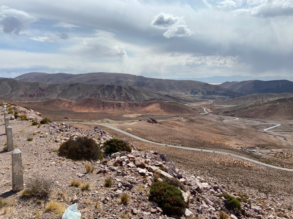
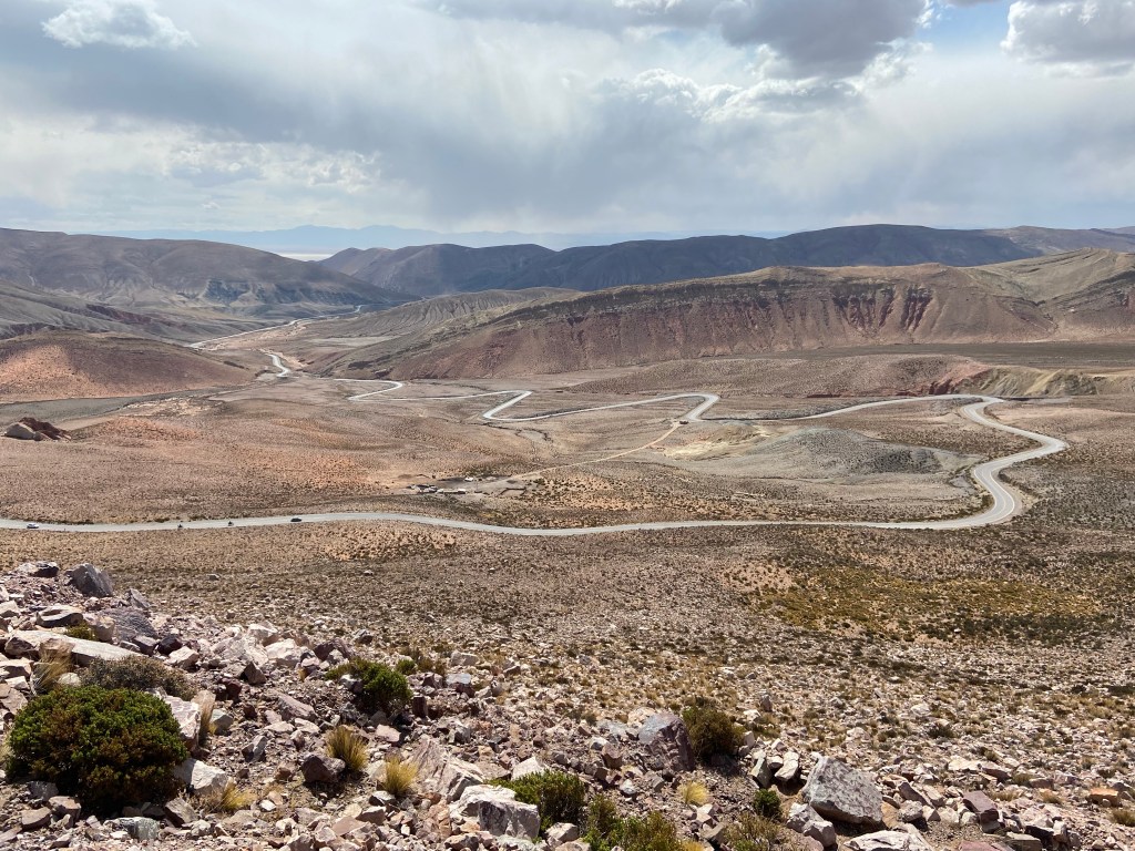
I had been undecided as to whether or not to visit the Hornocal – I wasn’t sure about driving there myself as the road to get to it is marked as unpaved on the map provided to me by the rental agency, but I knew I could get a shared taxi to it from Humahuaca, the nearest village. So I headed in the direction of Humahuaca – but by the time I got there I was already toying with the idea of at least giving the unpaved road a go – my sense of adventure having thus far been frustrated by the inability to explore the Senoritas hike alone. I figured I could always turn round if the road proved dreadful! I did some quick Googling to confirm that others have driven the road in a regular (non – 4×4) car, and headed up in the direction given by Google maps.
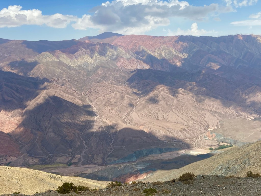
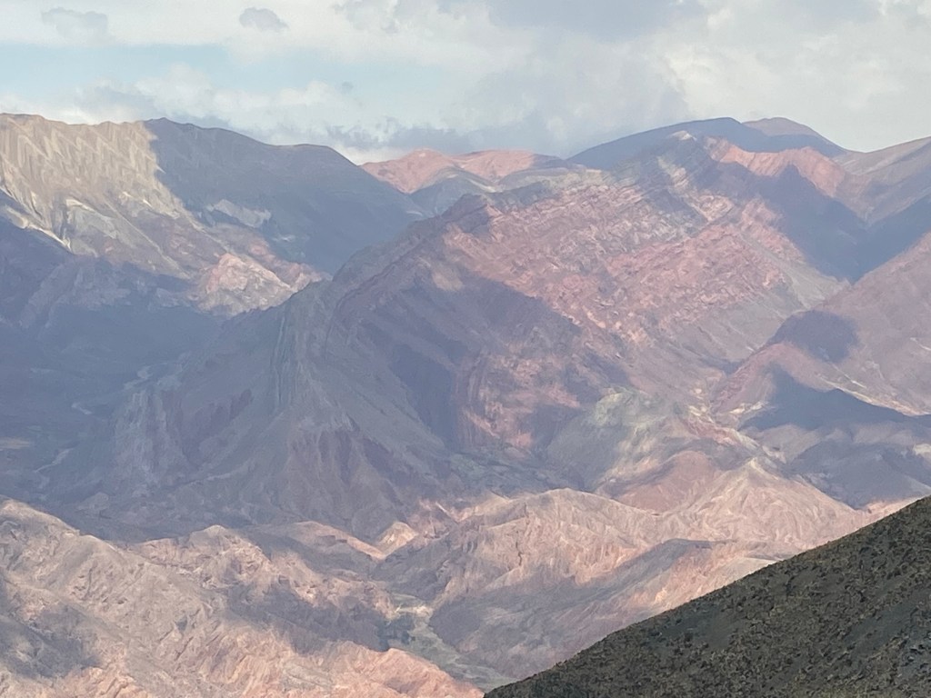
Well the road did prove fairly dreadful – 21km in length, very rocky and corrugated making it a bone jarring journey indeed! But I found that as long as I stayed in second gear and kept my speed down, it was just about bearable. And I even spotted a condor circling lazily overhead at one point, which went a long way to relieving the tedium of the drive. Surprisingly, as I got higher up and the road changed from straight uphill to switchbacks, the surface improved slightly – it was still rocky but somehow less corrugated. I even managed to get into third gear occasionally! It still took 45 minutes to make the 21 km journey and I was very relieved to finally reach the 4350m summit which is the main viewpoint.
There is a clear path downhill from the car park which allows one to get a little closer to the main panorama. I could see plenty of other people heading up and down the path so did the same. I was pleased to find I was having no trouble with the altitude – though of course I was heading downhill! I knew coming back up would be another matter entirely – everyone else heading up was breathing heavily and looking generally knackered.
Once I reached the end of the path I stopped and sat down for a while, just enjoying taking in the views and noticing how the shifting cloud cover altered the colours of the mountainside. But eventually I had to turn round and head back uphill – very slowly indeed! It’s probably only about 150m of descent and re-ascent but it certainly makes for hard work on the way up!

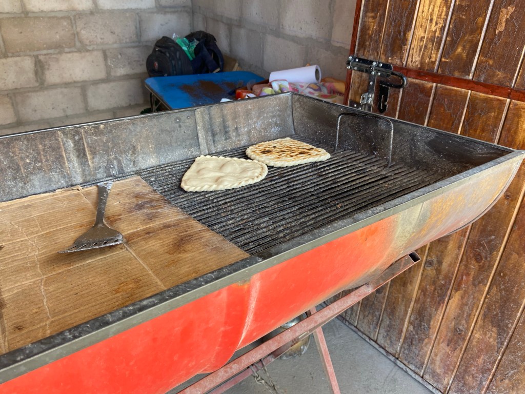
It was lunchtime by this stage and I was peckish, so decided to try one of the tortillas that a lady was preparing on a barbecue. I had seen people eating these in Purmamarca but hadn’t yet tried one. I was fascinated watching her turning it with her bare hands – she must have tough skin! And found it to be absolutely delicious, with the tortilla itself being lovely and light, and a ham and cheese filling for flavour.
The drive back down the dirt road to Humahuaca was thankfully much quicker and easier than the drive up had been. With gravity on its side, the Sandero rolled much more happily over the uneven surface and I even managed fourth gear on some of the straighter sections! I was still very happy to reach the paved road in Humahuaca though.
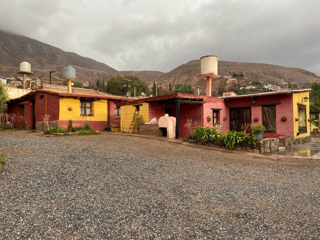
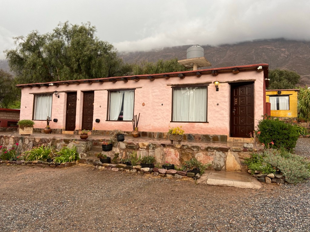
From there it was a straight run back to Tilcara where I had booked to spend the night. The heavens opened as I approached the village and by the time I reached the hostel, a river of rainwater was running down the middle of the road adjacent to the driver’s door of the car, so I was forced to clamber over to the passenger door to get out and investigate the parking situation. Thankfully the gate to the parking area proved easy to open and I clambered back in via the passenger door, drove in, pulled my suitcase out of the boot and left it under a nearby awning, ran back to close the gate, then went inside to check in.
The receptionist was nowhere to be seen but thankfully appeared within a few minutes, took my payment and showed me to my room, which was delightfully spacious. I settled in, had a shower and spent some time planning what to do and where to stay over the next few days – as well as investigating flights to Bariloche, my next destination after Salta.


It was still raining heavily by 8pm and I really didn’t fancy heading back out, but was pretty hungry – so put on my waterproof trousers and jacket and dashed out to the closest restaurant I could find – thankfully less then 5 minutes’ walk away. I had a delicious meal of braised llama with roasted vegetables, then headed back to the hostel where I had planned to carry on sorting out my itinerary, but the heavy rain and accompanying lightning had knocked out both the Wi-Fi and my phone signal, and I found myself completely unable to connect to the internet – highly frustrating! I wasn’t in the mood for reading, so decided to have an early night and hope either the Wi-Fi or 4G would be sorted by the morning.
The Wi-Fi still wasn’t working in the morning, but the rain had stopped and the 4G had returned, so I managed to book my accommodation for the next 3 nights – I’d decided to base myself back in Salta for the final 2 days and do day trips to Cachi and Cafayate, rather than staying overnight in either. But in the meantime I still had the day free to explore the remaining parts of Jujuy province that I hadn’t yet seen – including the salt flats.
I headed off first in search of the Castillos de Huichara – a walk I’d read about, just outside Tilcara, which looked particularly scenic. But Google maps directed me down another unpaved road, and after driving a couple of kilometres along it with no sign of any other cars or any kind of indication that there may be a car park ahead, I turned round and investigated a different dirt road that I’d seen forking off up the hill to what looked like it could be some kind of building. But that proved to be a small graveyard and so I continued past it and back onto the original road, trying to decide whether to continue a bit further along it. Happily at this stage another car approached from the opposite direction and I was able to ask the driver if the Castillos walk was up ahead. She responded not, so I gave up and headed back to the main road. I still have no idea where the correct starting point is!
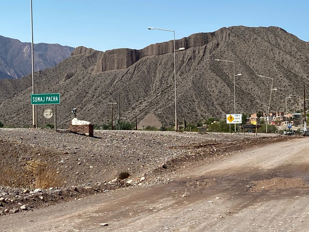
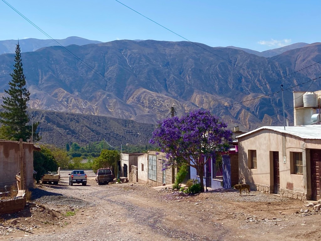
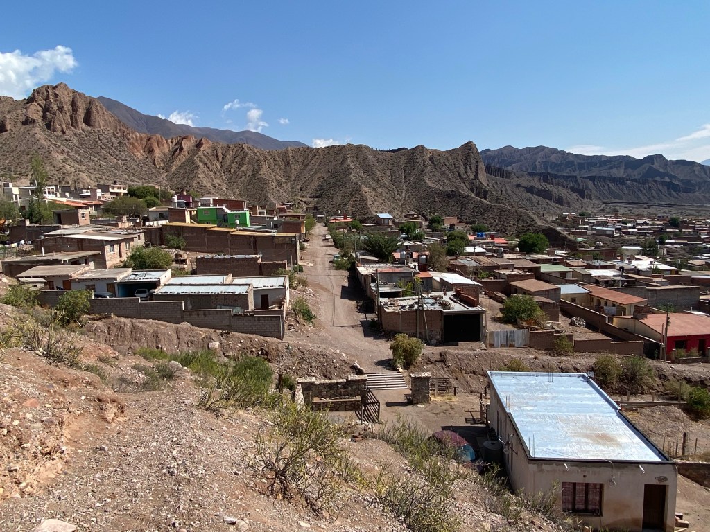
My next stop was a nearby village called Sumaj Pacha, nestled at the bottom of the dramatic peaks I’d been admiring from the dirt road (and which the walk I’d been looking for supposedly allows one to explore from up close). I wanted to investigate whether there were any trails leading out of the village that would take me up the mountainside. I was quite charmed by the village itself though, which has a mixture of very plain and really rather lovely houses, and I wandered happily around for a while before finding a path that led onto a ridge which I could walk up to get a better view of my surroundings. I half expected someone to come and yell at me for hiking alone, but thankfully nobody did!

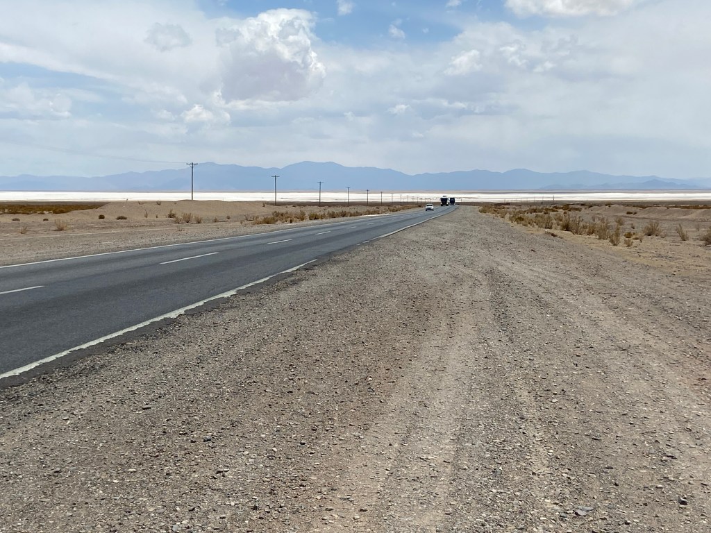
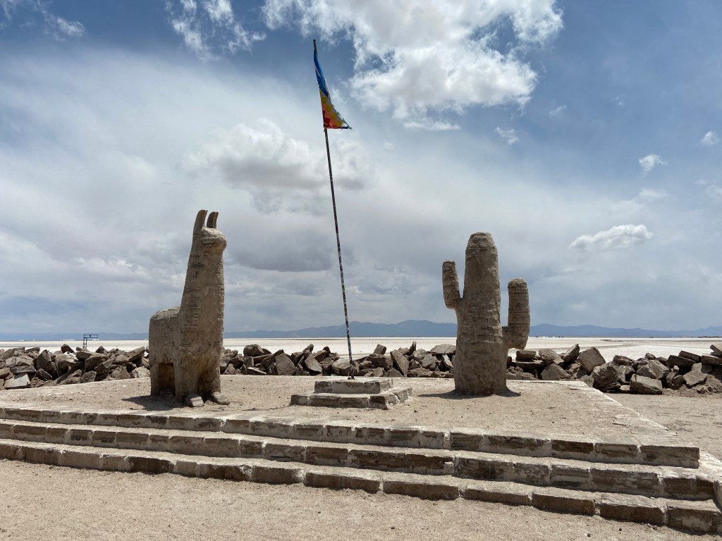
Having finally satisfied my desire to explore beyond the typical tourist attractions, I decided that was enough hiking for a hot day, so headed back to the car and drove, via Purmamarca, to Salinas Grandes.
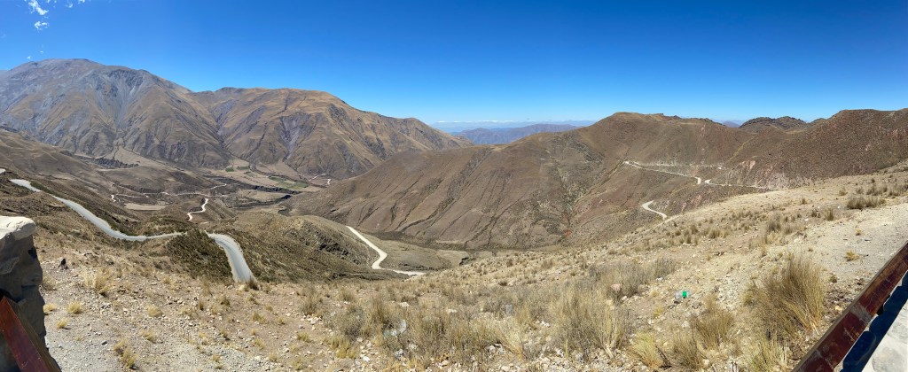
This was an absolutely spectacular drive. The road is perfectly paved, and twists and turns its way up the mountainside to an altitude of 4125 metres, before heading back down to the salt flats, which are at 3450 metres. There is a viewpoint a short distance below the summit from which I was able to take these photos of the road heading up the pass – and my beaming face having enjoyed it so much!
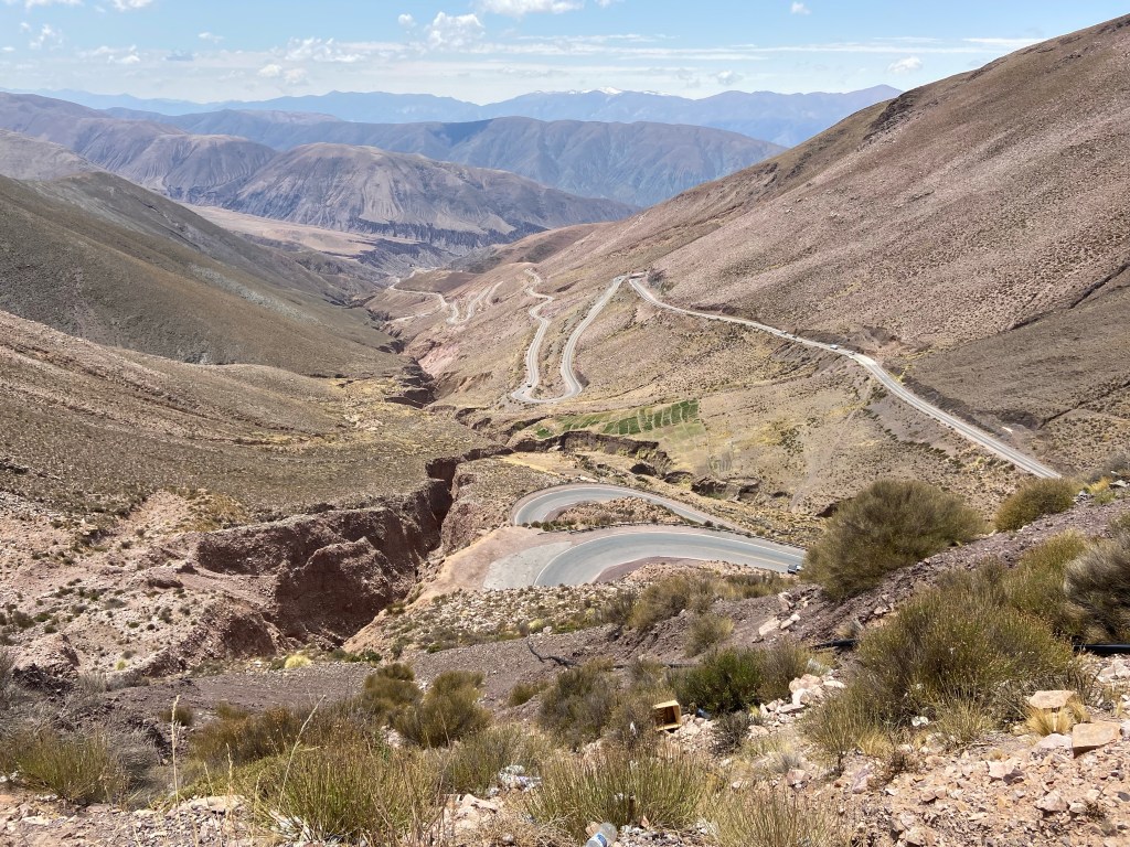

There are no designated viewpoints heading down the other side but it is possible to pull over at various points which I of course did!
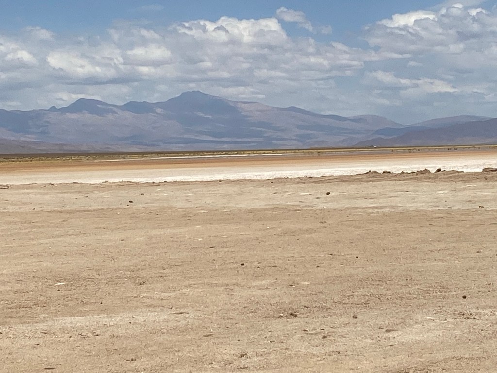
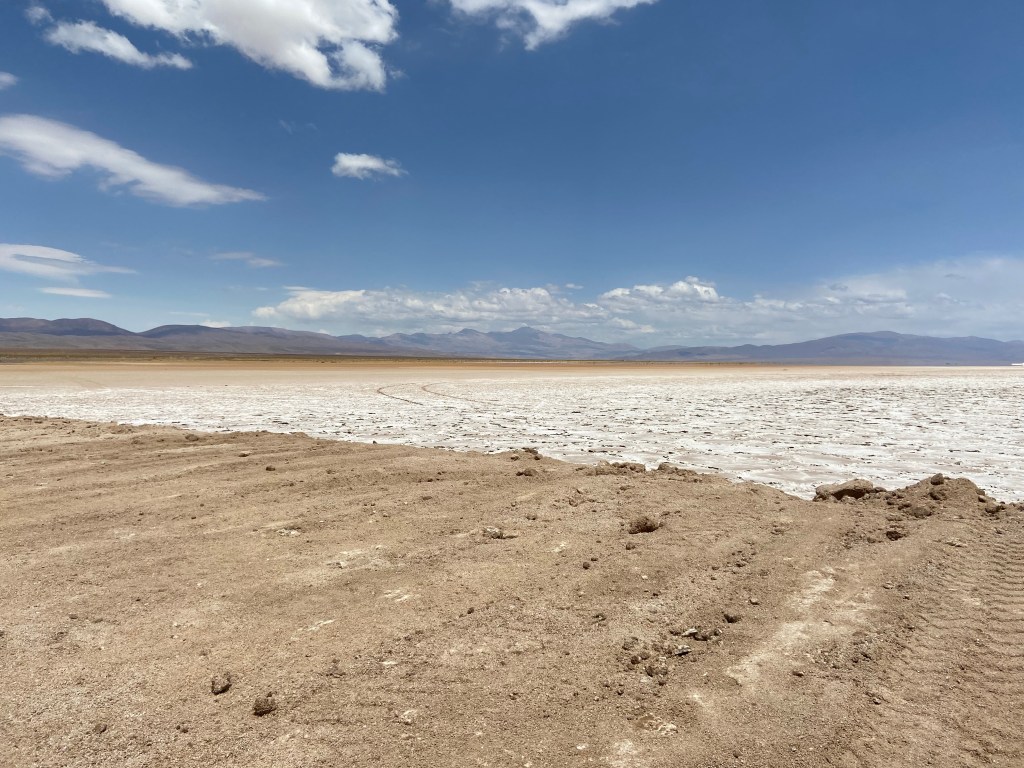
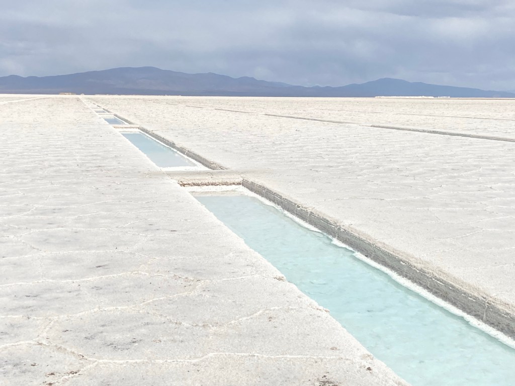
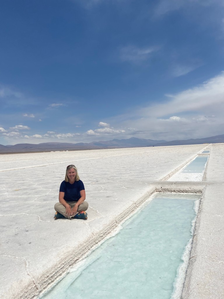
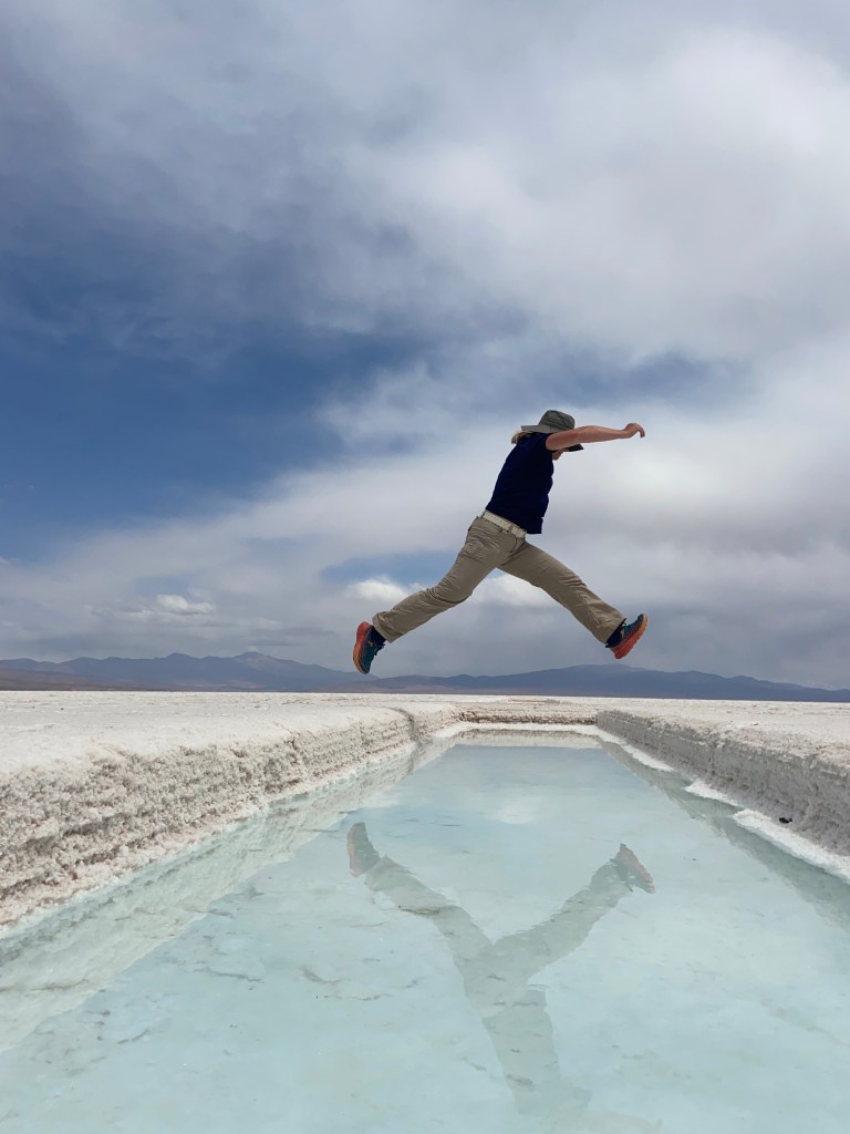
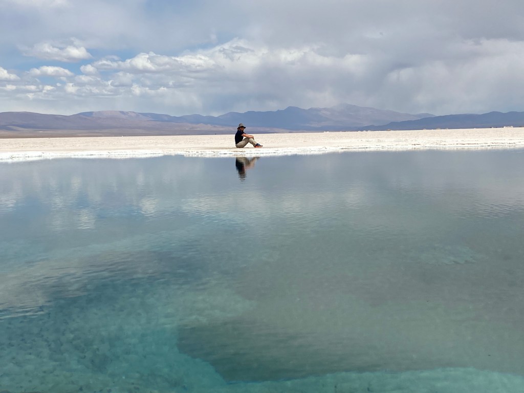
At the Salinas, I paid for a guided tour of the salt flats. This involves driving one’s own car onto the flats, following a guide on a motorbike. With three cars to one guide, we had a couple of stops for the guide to explain how the salt flats were formed and how the salt is harvested – and to take the obligatory perspective shots! Overall a thoroughly enjoyable experience.


After wolfing down another very tasty tortilla (it was about 3.30 by now and I hadn’t eaten since breakfast) I set out to drive back to Salta – thankfully, apart from having to pass the same section of roadworks that I’d found so tiring two days ago, the overall journey was fairly smooth and I was at the hotel shortly after 6.30, which allowed plenty of time to shower, settle in and then head out to eat.
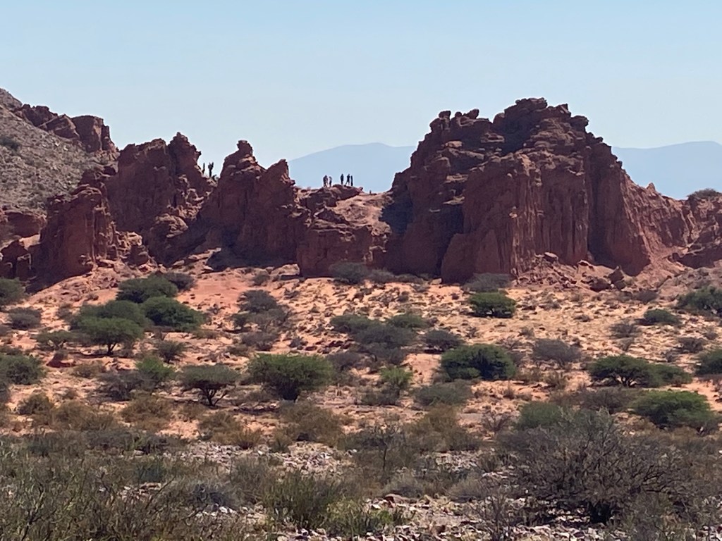
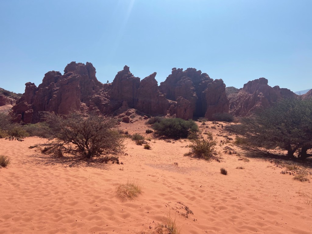
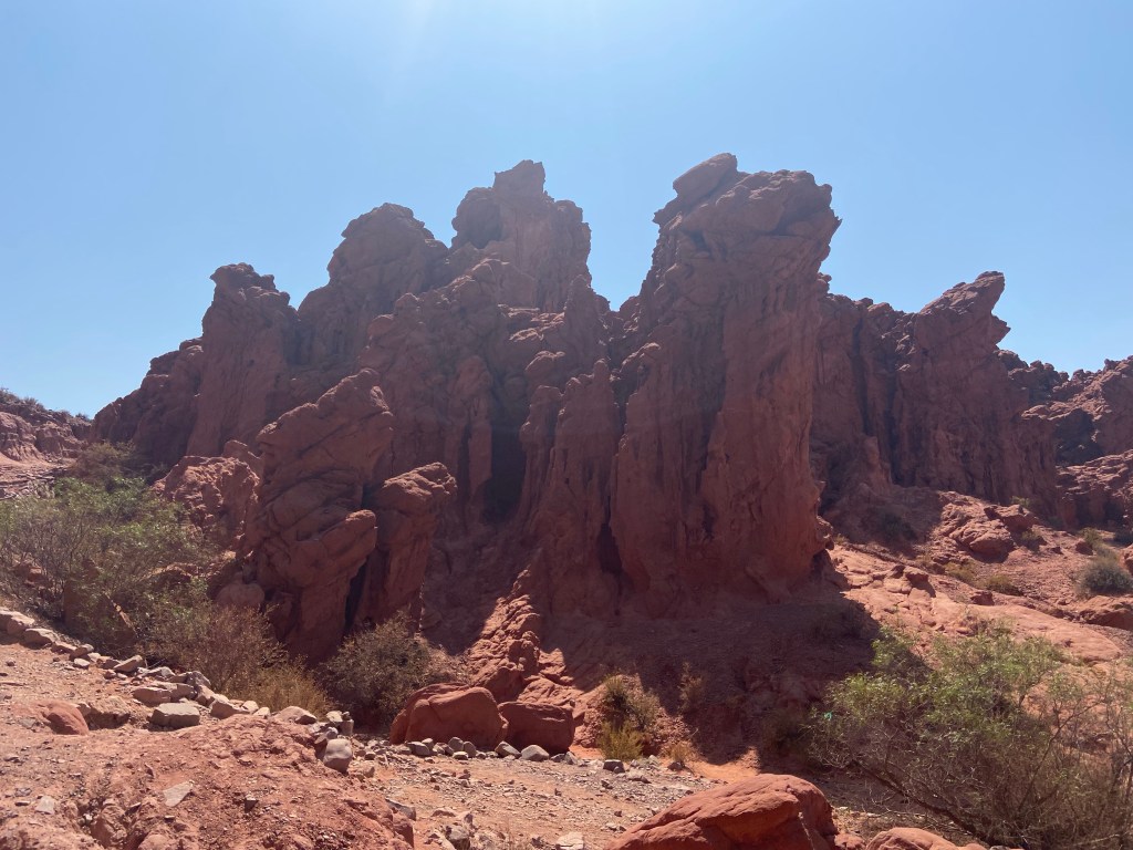
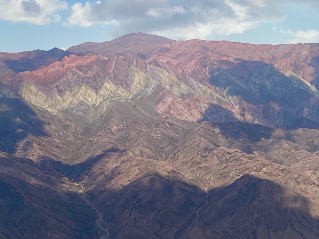
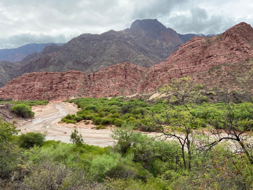
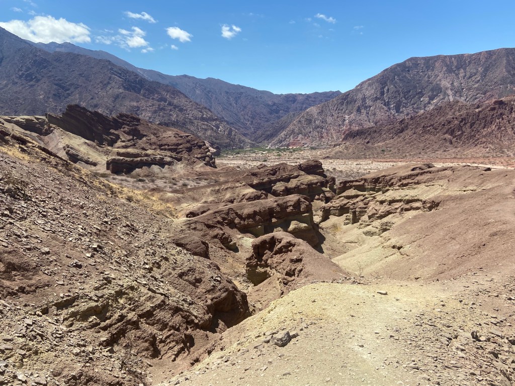
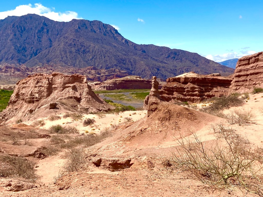
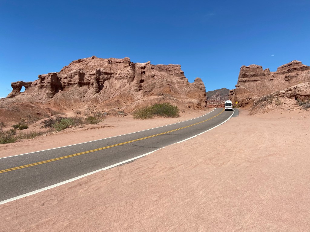
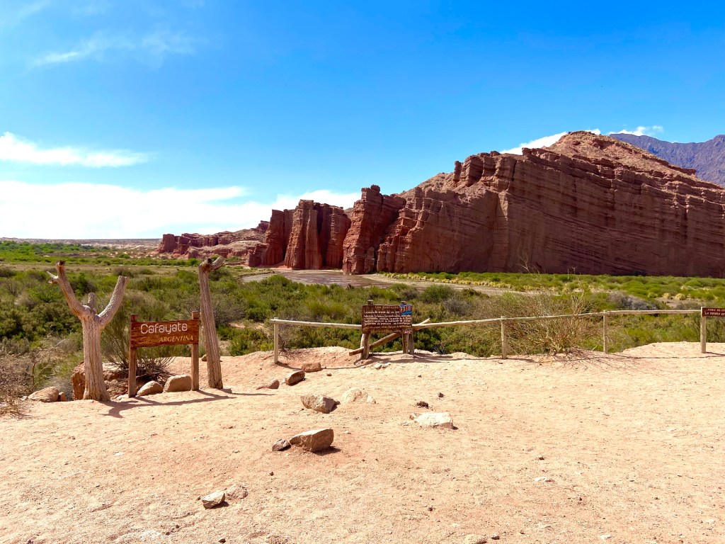
Day 4 was a very long day indeed! The journey from Salta to Cafayate is on a fully paved road and, according to Google maps, should take just over 3 hours. The first 2 hours is tedious, passing through numerous busy villages between Salta and a town called Coronel Moldes. Traffic is fairly heavy and progress is slow. But then one reaches the final section, the Quebrada de las Conchas, and progress slows down further as the jaw-dropping scenery tempts one to pull over repeatedly to take photos or to explore the signposted attractions along the way. It took me 4 hours to drive the final 68 km section of the road because I stopped so many times – including a one-hour hike at Los Estratos to explore these spectacularly colourful mountains.
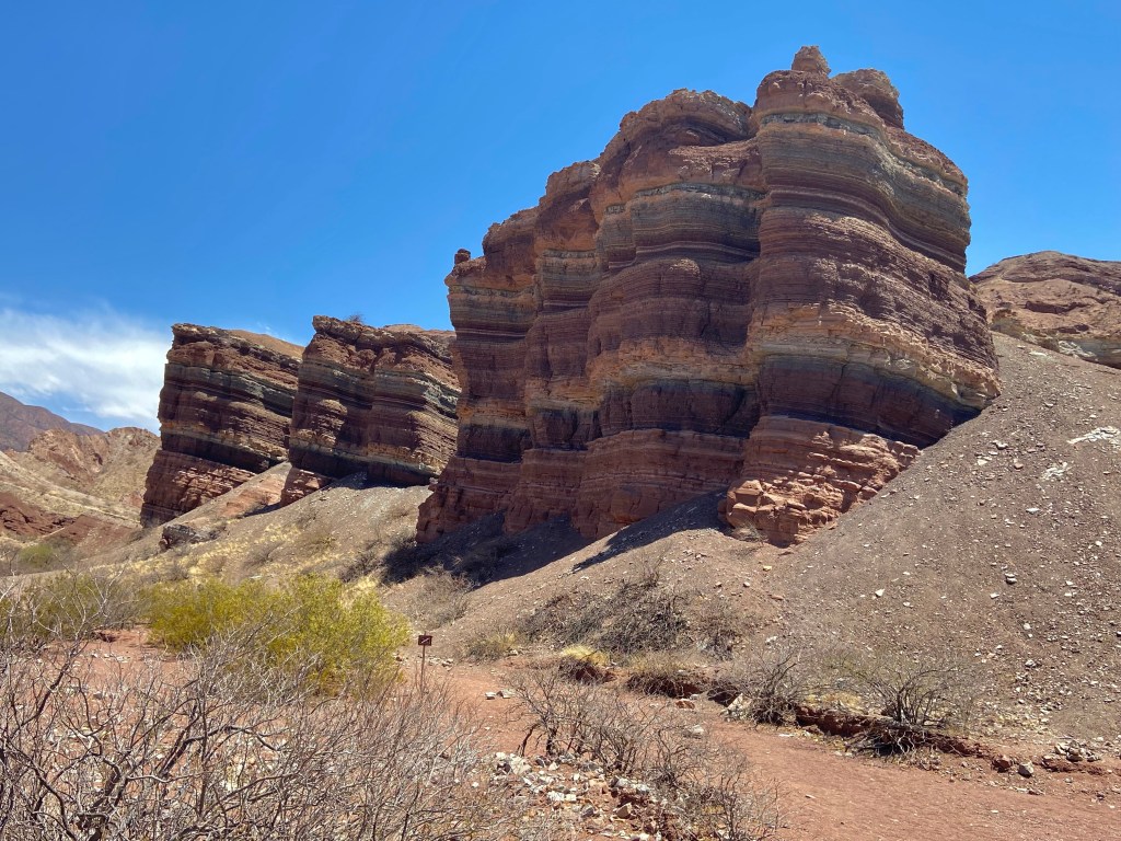
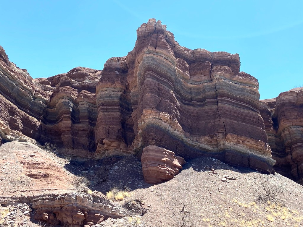
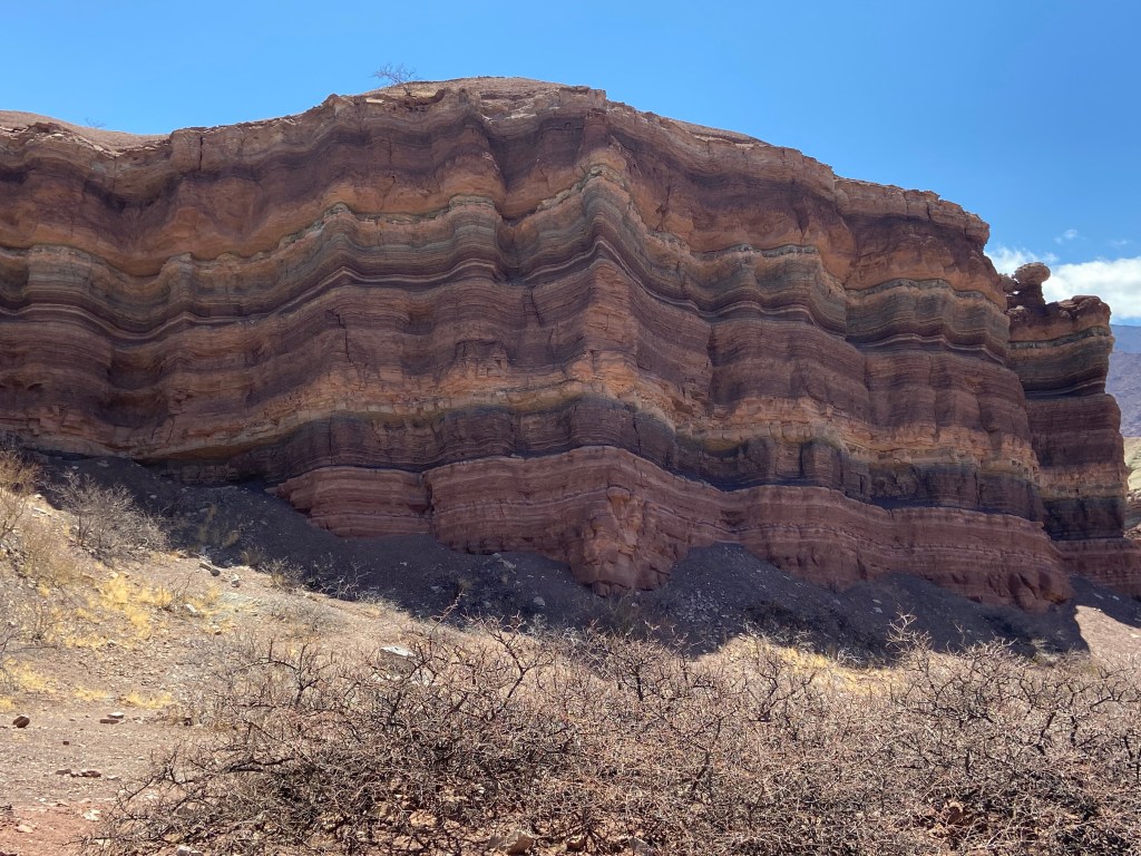
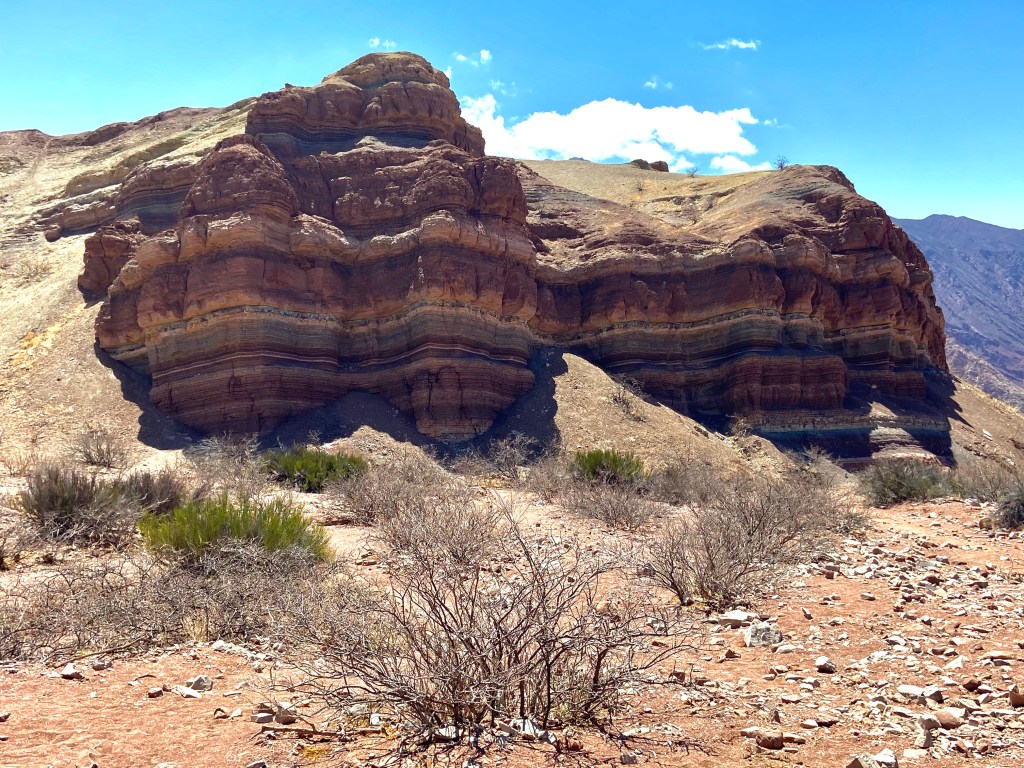
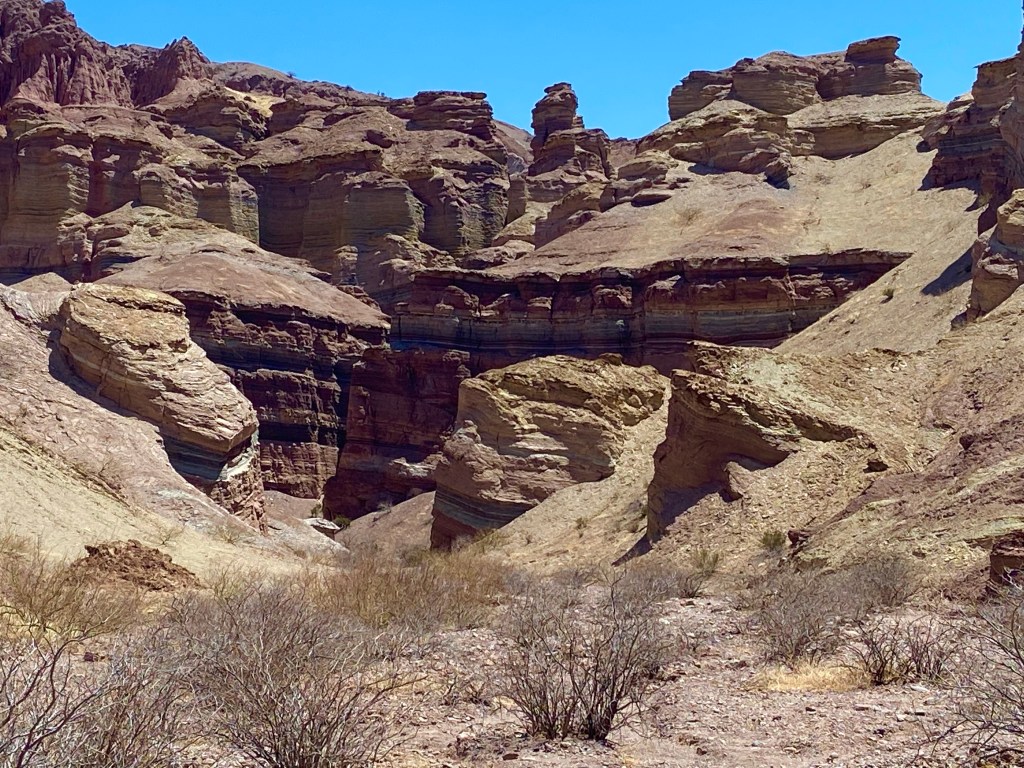
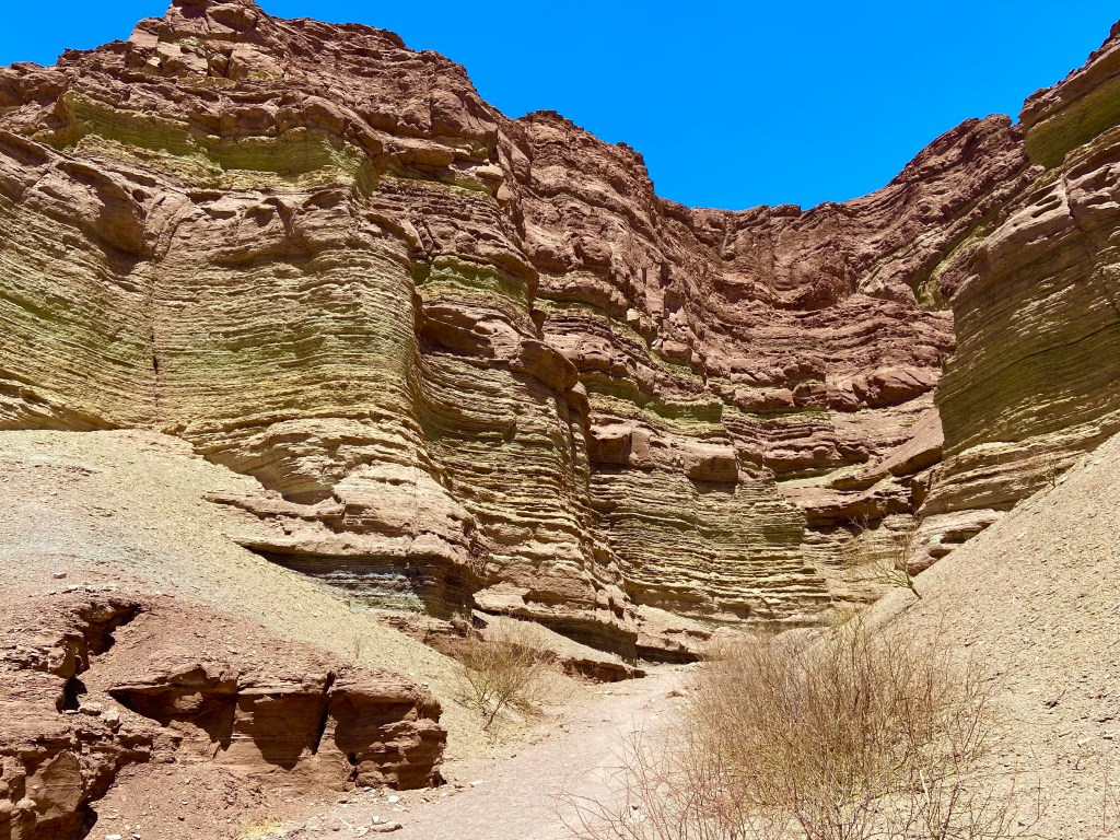
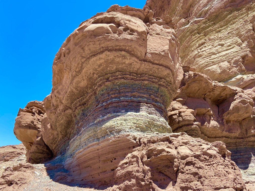
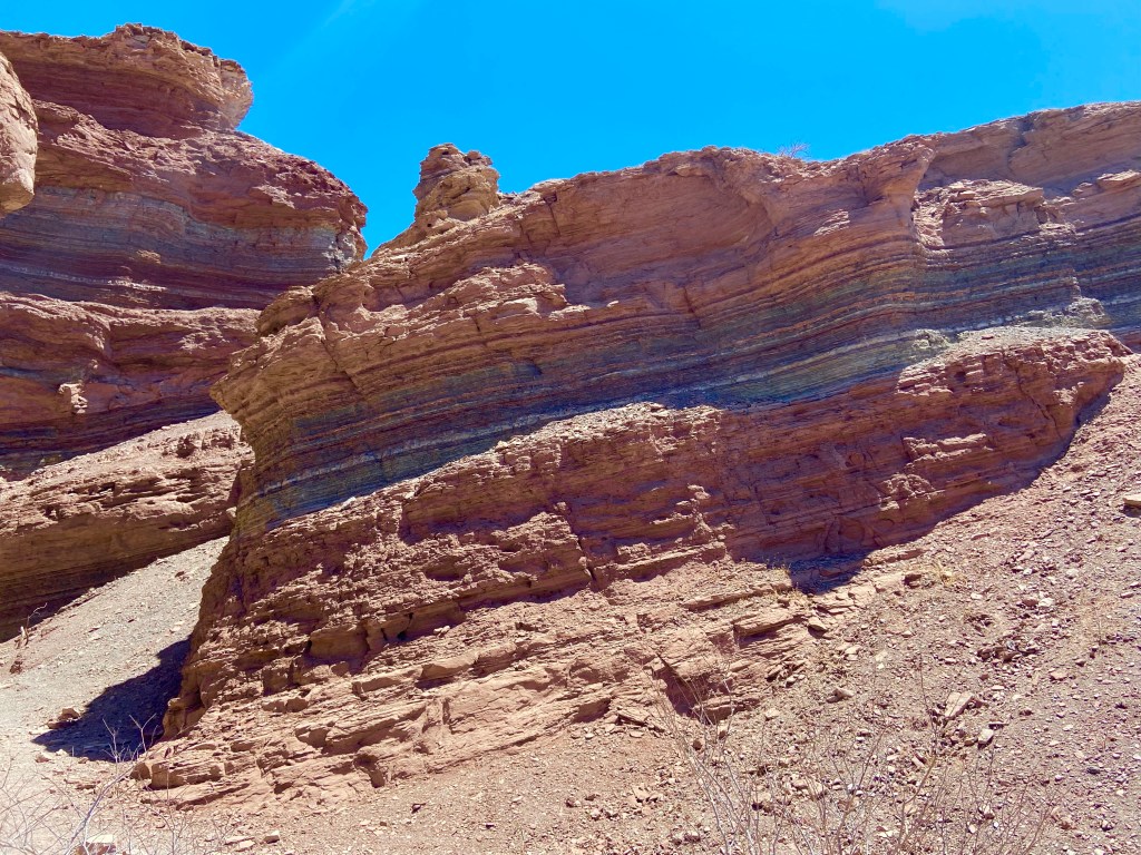
This area is truly a geological wonder with differently coloured mountains looming on either side of the valley, and constantly changing views.


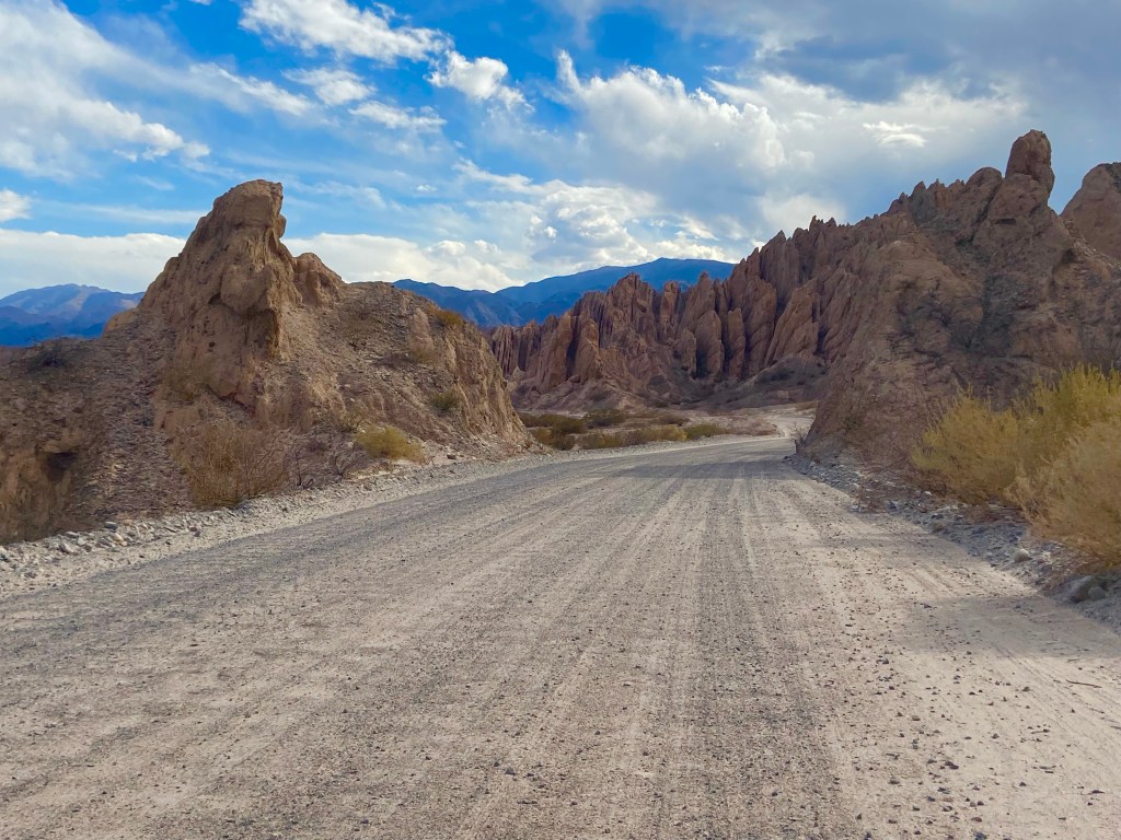
At Cafayate I stopped briefly to find a loo and buy some more water, then carried on to the Quebrada de las Flechas, a section of the road from Cafayate to Cachi which is very popular for the fact that it winds its way through a dramatic set of jagged-peaked hills. This part of the road is all unpaved, but I was completely used to unpaved roads by this stage, and although the drive was a little uncomfortable, I reached the main viewpoint which was my ultimate destination, shortly after 5pm.


I now had a decision to make. I could continue along the dirt road to Cachi and spend the night there, driving back directly from Cachi to Salta the next day. But I had specifically not planned to stay over in Cachi because it’s above 2000m in altitude – and with all my stuff back at the hotel in Salta, I wasn’t that keen on an unplanned overnight stop. Plus I had no idea if the rest of the road would be in the same condition as that which I’d just driven.
Another option was to just drive back to Cafayate and spend the night there, driving back to Salta the next day. But this would mean not seeing Cachi at all, as I had planned to do a day trip from Salta to Cachi and back on what would be my final day with the car.
In the end I stuck with my original plan, turned round and drove back to Salta. I was stopped at one point at a regular police stop (these are very common, particularly in Jujuy province; I encountered at least one every day. Most of the time you just slow down and are waved through but occasionally you’ll be asked to produce licence and registration). On this occasion the policeman asked to see my licence and asked if I live in Cafayate (it was dark by this stage and the roads were fairly quiet; I get the sense very few tourists drive at night). I explained that I am a tourist and was staying in Salta – he said something that I didn’t understand but when I told him I hadn’t understood he just smiled and waved me on. I was absolutely shattered by the time I reached the hotel around 10pm – I was also ravenous but couldn’t face heading out in search of food, so had to make do with three small granola bars that I had left from the large stock I’d bought weeks ago in Peru. I fell into bed vowing not to bother with Cachi – I simply couldn’t face another long day of driving with the added pressure of having to return the car by 5.30 pm.
However, I slept very well and woke up just before 6 am feeling fully refreshed (though still very hungry) and decided that if I got going early, I could easily get to Cachi and back by 5.30. Sadly I found the parking garage locked and had to wait for it to open at 7 am, before I could get on the road, having decided to stop for breakfast in El Carril, about an hour into the journey. Sadly the cafe I stopped at didn’t offer a proper cooked breakfast so I had to make do with the seemingly traditional Argentine breakfast of coffee, orange juice and two medialunas (small glazed croissants). This barely satisfied my hunger but the coffee at least perked me up!
The scenery improved shortly after leaving El Carril and after a further hour I stopped at a roadside cafe to buy a couple of empanadas, which I enjoyed sitting outside in the sunshine before carrying on with the journey.
And shortly thereafter I reached the Cuesta del Obispo, an amazing feat of engineering which winds its way all the way across the hillside as it climbs to the top of a pass. Sadly the majority of it is unpaved and rather unpleasant to drive as it’s bumpy and dusty – but the view down the valley from the viewpoint near the top makes it worthwhile. Nevertheless the relief on finally returning to properly paved road, just before the top, was immense.
From here it’s a short descent to the Recta del Tin Tin (Tin Tin Straight) which is as straight as the name suggests and gloriously traffic-free.
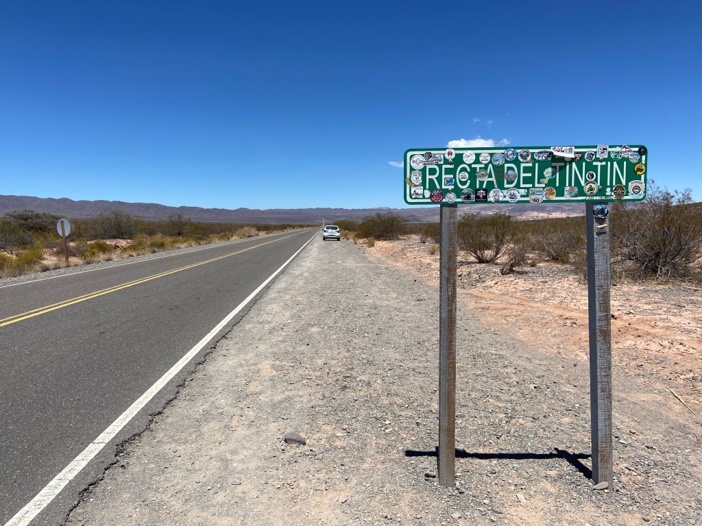
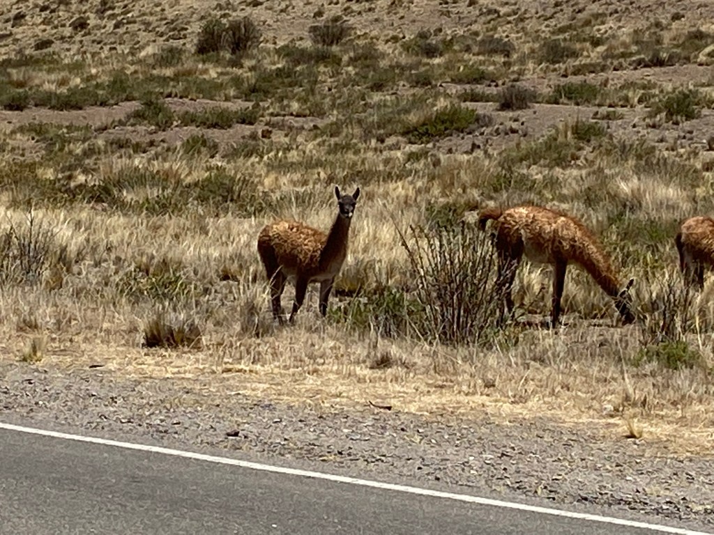
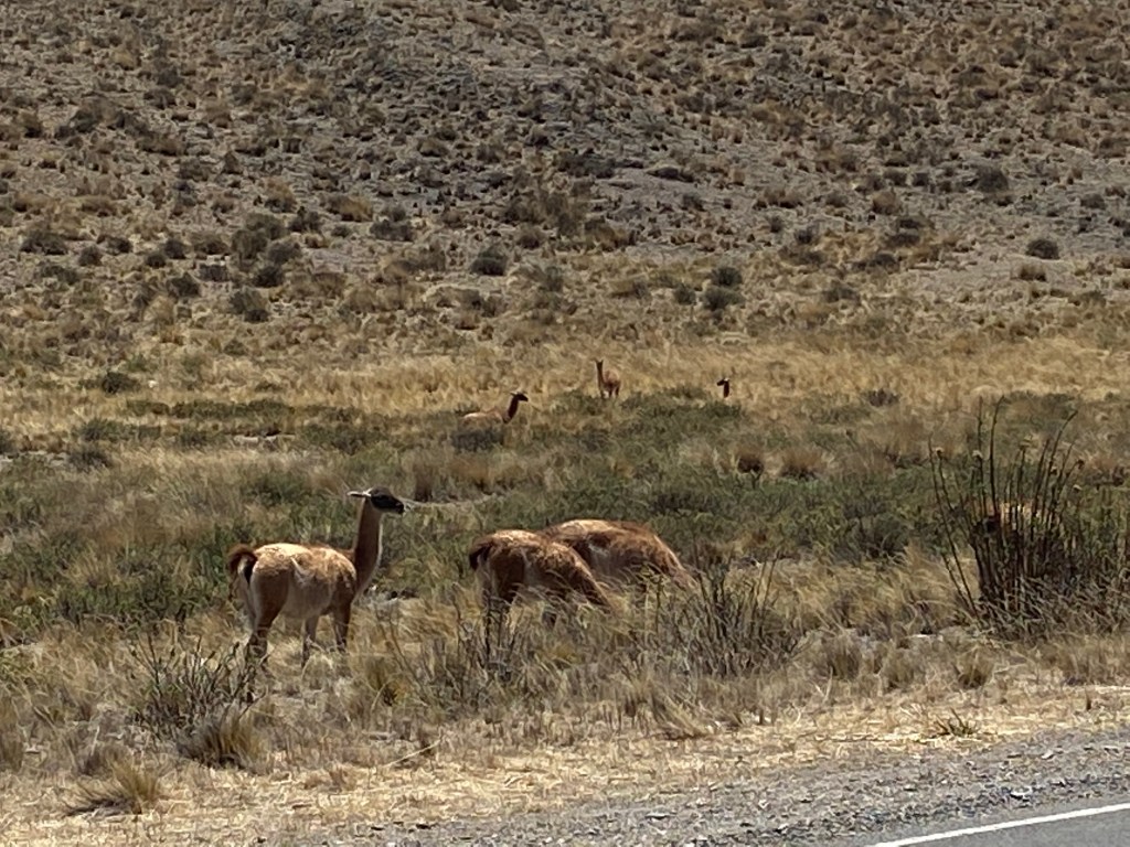
It is tempting to put one’s foot down – but with vicuña and llamas grazing on either side of the road and occasionally wandering into it, it’s safer to keep one’s speed down – and the advertised limit is 60 kph. I genuinely didn’t understand the need for the “no overtaking” signs at the roadside though – on such a straight road where one could see for miles and where oncoming traffic was virtually non-existent, I couldn’t think of a safer spot to overtake if one happened to be following a particularly slow vehicle. But there was a lot that didn’t make sense to me where Argentine speed limits and road signs were concerned! And I did find myself overtaken on the way back – by someone who was clearly doing closer to 100kph than 60! In the entire 5 days, I didn’t actually witness a single accident – so despite appearing to have very little respect for traffic rules, Argentine drivers do appear to know what they’re doing!

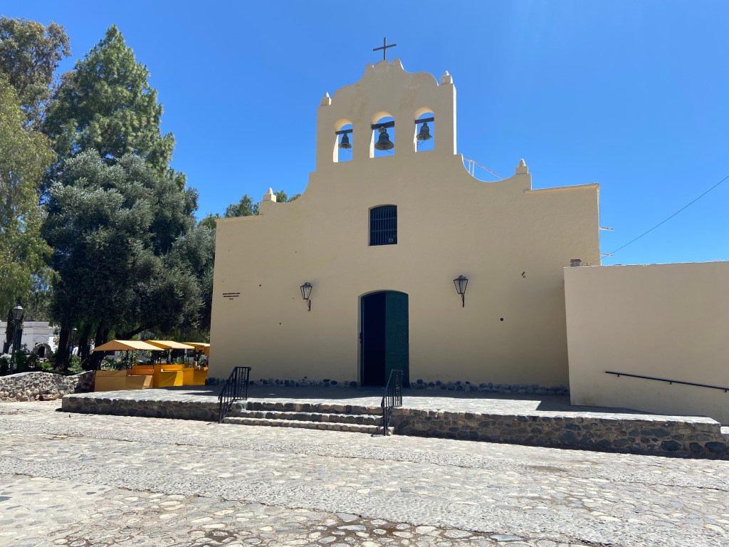
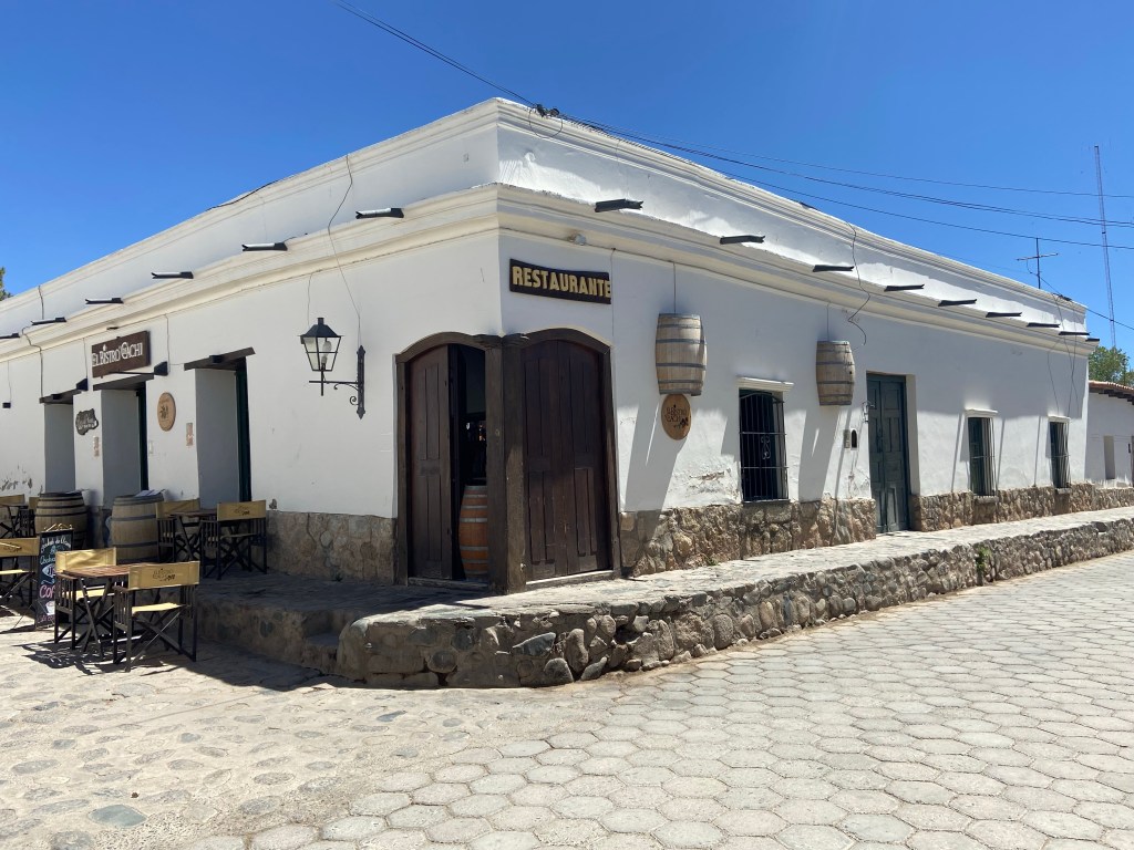
I reached Cachi at 11.45, which gave me time to find a loo and have a quick wander round before sitting down to have some lunch and another coffee at one of the many cafes in the village.
Then it was back to the car for the drive back to Salta! Thankfully the Cuesta del Obispo, like other roads before, was much better on the way down than on the way up, and with fewer stops (including a final stop to fill up the petrol tank) I was back at the car hire garage shortly before 4.30. An agent came straight out to check the car over, soon giving it the all-clear (it was very dusty but otherwise undamaged). And that was the end of my road trip! It was with a huge sense of relief and accomplishment that I walked the short distance back to my hotel.
If I were to do it all again, I probably wouldn’t change anything about the first 3 days. But I definitely wouldn’t do the two day trips again, to Cachi and Cafayate. I’d either do each with an overnight stop, allowing 4 days in total rather than 2, or use 3 days in total to drive first to Cafayate, then on to Cachi, then back to Salta on day 3. And with even more time available, I’d have an extra night or two in Cafayate to visit some of the many wineries in the area – and to revisit some of the beautiful scenery!

Leave a comment